UAV Aerial Photogrammetry: Aerial Precision at the Service of Mining and Construction
GFDas UAV aerophotogrammetry offers high-resolution aerial mapping using unmanned drones, ideal for obtaining an accurate and detailed view of the terrain.
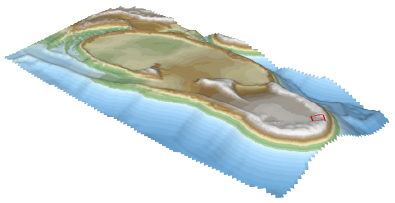
Our service allows you to generate digital elevation models (DEM) and 3D surfaces, providing crucial information for decision-making in mining, infrastructure and energy projects.
What makes our Aerophotogrammetry unique?
High resolution orthorectified images
Access geological information in covered or difficult-to-access zones. GeoMagDrone™ allows you to identify blind targets, deep mineralizations and geological structures in exceptional detail.
Advanced 3D topography
Thanks to drone technology, we can provide accurate and up-to-date data on the ground, facilitating the planning and execution of projects in hard-to-reach areas.
Volume and Earthwork calculations
Our technology allows us to accurately measure the volume of materials and land, optimizing resource planning and avoiding cost overruns.
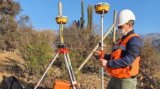
Our Experience and Professional Team
Since 2017, GFDas has been a pioneer in the use of drones for various applications. We have the AOC certification from the DGAC (Chile) and in the process of obtaining BARS (international)
Main benefits
Efficiency
Reduced processing time thanks to next-generation drones and the reduction of ground checkpoints.
Security
Eliminates the need to expose personnel to risky or difficult-to-access terrain.
Precision
Highly reliable data for projects that require millimeter accuracy in their planning and execution.
Applications of UAV Aerophotogrammetry
Mining
Optimization of mining operations planning with precise digital models.
Construction and infrastructure
Definition of paths, inspection of plants and facilities, and control of progress in real time.
Environment
Monitoring and conservation of natural areas with detailed images and terrain analysis.
Elevate your analytical capacity and make decisions based on accurate and detailed data.
With high scalability, efficiency and a risk-minimizing design, GeoMagDrone™ is the number one choice for those looking for fast, accurate and reliable results.